Why deadly spring snowstorms shouldn’t really surprise you
As the great American philosopher Yogi Berra aptly said, “It ain’t over ‘till it’s over.” That’s certainly the case with winter.
May 1, 2019
By Becky Bolinger from Livestock WX
Those who live and ranch in the Upper Midwest and High Plains already know that after spring has started, there is still a risk for winter to throw into the mix one or two final surprises. This reminder is timely just in case anyone had gotten too complacent and let a few warm days fool them into letting their guard down.
While spring blizzards are more common in April, the risk of large accumulating snowfall events still exists even in May. Some stations in the Midwest have seen 6 inches of snowfall at least once in May. A few locations in the Dakotas, Montana and Wyoming have experienced between two and five days of 6-inch snowfall events in May.
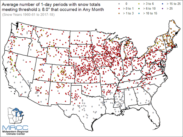
Ever wondered, though, how often significant snowfall events happen in April and May?
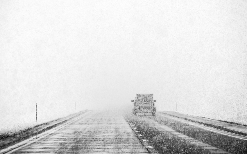
In mid-April, another powerful storm system hit the Plains, bringing strong winds, snow, and blizzard conditions from the Rockies all the way to the Great Lakes and Ohio River valley.
Three different stations in South Dakota broke their daily snowfall records for April 10, 2019, according to NOAA’s National Centers for Environmental Information. While snow in April may have sounded surprising to some, this is not the first time a large April storm has blanketed the Plains in white.
Consider this example: Back in April 2013, areas in Montana, Wyoming, Colorado, and east through the Dakotas, Nebraska, and into Minnesota received between 2 and 10 inches from the 15th to the 18th. Several other springtime examples have brought devastation to livestock producers.
Most remember 1997 and the early April blizzard in North Dakota that hit in the middle of calving. The storm killed an estimated 100,000 head of cattle, most of those being calves and yearlings.
In 1966, a March storm hit a similar area in North Dakota and Minnesota. That storm unleashed 70 mph winds and resulted in drifts of 30 to 40 feet, killing approximately 20,000 head of cattle.
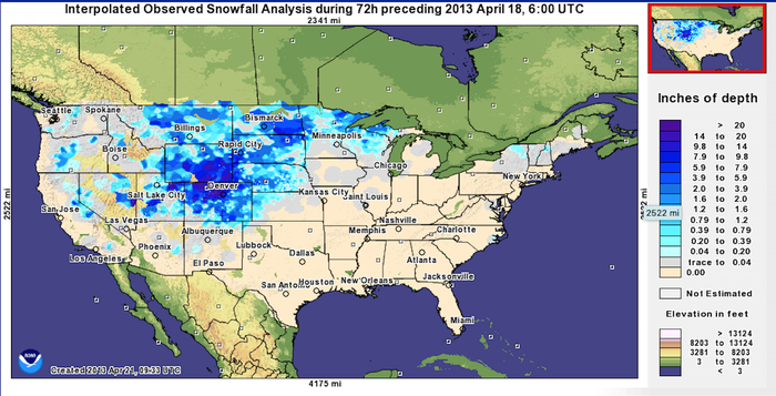
Average April high temperatures across the north and High Plains typically reach above 50°F. But it’s still quite easy for troughs of strong low pressure to pass through the region and bring temperatures down to well below freezing.
Consider Scottsbluff, Neb., where average high temperatures are over 60°F after April 10, and average low temperatures warm up above freezing by April 19. And yet, each year, Scottsbluff sees colder-than-freezing temperatures an average of 5-10 days from mid-April through May.
According to data from the Midwestern Regional Climate Center, long-term average snowfall after April 15 totals more than an inch along the Colorado Front Range, throughout most of Wyoming and Montana, and across the Dakotas. Snow in late spring is a given.
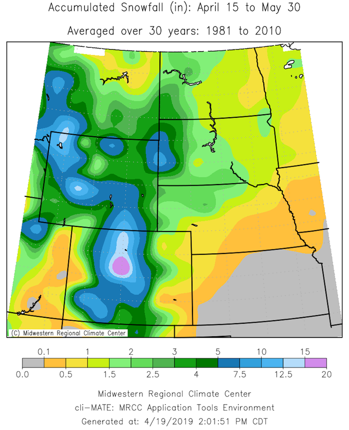
One to 2 inches of snow in the spring isn’t really associated with major impacts. But crops and livestock can be sensitive to a larger accumulating event. The Midwestern Regional Climate Center has an archive of Snow Climatology Maps where a user can look up averages and different snow statistics across the country for every month of the year.
The information above is helpful for you to tuck into your long-term planning for next year.
What we’ve experienced this spring is a good reminder that spring doesn’t always mean thunderstorms, warmer temperatures, and blooming flowers. Snow, winds, blizzards, and cold temperatures can and do occur. Assessing your risk for these events, as well as paying close attention to the weather forecasts, can help you prepare and minimize the impacts.
Bolinger is Colorado assistant state climatologist. She is a frequent contributor to the U.S. Drought Monitor and writes for Livestock WX, the source of this article.
You May Also Like

