Subscribe to Our Newsletters
BEEF Magazine is the source for beef production, management and market news.
Track forage patterns in one pasture or over an entire landscape.
September 17, 2020

If a hailstorm, tornado, or blizzard is bearing down, ranchers work double time to protect their livestock and pastures from potential damage. They also rely on weather reports to monitor the storm’s progress.
Now we can track approaching ecological threats—like weeds, encroaching trees, or declining forage—as easily as we track the weather.
Revolutionary new technology allows landowners and resource managers to monitor changes in vegetation and production on America’s grazing lands. The Rangelands Analysis Platform (RAP) is a free online tool that provides the first-ever comprehensive view of how vegetation is shifting in the western half of the U.S.
After just a few minutes on a computer or tablet, beef producers can see how their rangelands are faring. Not only does RAP show the type of vegetation, it also instantly shows landowners the grass productivity of their pastures in pounds per acre. That means we can see how, where, and when forage production has increased or decreased.
"Technology like RAP is an early warning system to help ranchers get ahead of any problems. It’s another tool to protect rangelands and ensure agricultural operations are profitable,” explains Dirac Twidwell, rangeland ecologist at the University of Nebraska-Lincoln and a science advisor for the USDA NRCS Great Plains Grasslands Conservation Initiative.
This new online monitoring application monitors vegetation from the Great Plains to the Pacific Ocean using field data and satellite imagery from 1984 to the present. It provides easy-to-read maps and charts using the power of Google’s cloud computing. Users can zoom out to see vegetation and production at county or state levels or zoom in to see changes within a single pasture
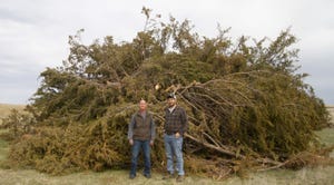
Twidwell points out how ranchers can use RAP to get a grasp on regional threats, like eastern redcedar expansion in the Great Plains or juniper encroachment in the Great Basin. In the absence of historic fire patterns, these woody species have marched across rangelands at alarming rates, diminishing forage and water availability.
Take the Flint Hills of Kansas, for instance, where the volume of eastern redcedar has increased more than 23,000% within its native range since 1965. On average, America’s rangelands are losing about 360,000 acres per year to encroaching trees
A recent study used RAP to evaluate 20-year trends in woody expansion at national, regional, and local scales. Roger Sheley, editor of Rangeland Ecology and Management where the study was published, says, “This new era of monitoring and assessment has the potential to take rangeland ecosystem management beyond the reactive realm of treatment of undesirable conditions to the proactive realm of prevention.
On a positive note, the study also identified case studies in Oregon and Nebraska where proactive, collaborative efforts to remove conifers led by USDA NRCS Working Lands for Wildlife are successfully restoring the range.
Another application for RAP is helping land managers prioritize where to tackle growing annual invasive grass infestations. In Idaho, a collaborative group of ranchers, USDA NRCS staff, state agencies and other partners recently launched the ‘Cheatgrass Challenge’ to combat weeds. The group used cutting-edge satellite maps to identify areas with low to moderate infestations for proactive treatment options.
“I’ve seen first-hand how beef producers come together quickly to solve a problem once they understand the scale of a threat like weeds or tree expansion,” says Twidwell. “We can get ahead of these threats with technology like RAP so they don’t take land out of agricultural production.”
Big data and computer-based applications like RAP are handy for informing management decisions, but these technologies work best when paired with real-world knowledge of a specific landscape. Just as weather reports are helpful for planning out a week’s work, nothing beats stepping outside to feel the wind and check the sky—or in the case of monitoring vegetation, looking to see what’s growing on the ground.
Livestock associations across the West are familiarizing themselves with RAP. Many landowner groups are promoting this technology as a way to efficiently monitor private properties as well as public grazing allotments.
“RAP is a simple, turn-key, and useful tool for ranchers to track grass productivity on public and private rangelands,” says Terry Fankhauser, executive vice president of Colorado Cattlemen’s Association.
To learn more about how to use RAP to manage and monitor rangelands, watch this free, one-hour webinar recorded by the USDA NRCS.
Randall is a freelance writer based in Missoula, Mont. The opinions of the author are not necessarily those of beefmagazine.com or Farm Progress.
You May Also Like
Enter a zip code to see the weather conditions for a different location.