Midwest flooding continues, outlook says hunker down for more
As winter slogs its way into spring, severe and dangerous flooding remains a concern.
May 2, 2019

Too much is simply too much. Many parts of cattle country have been battered by severe weather all winter. Then came the flooding. And more flooding.
Keep fighting, because the prediction is for more.
READ: El Nino intensifies; What's that mean for spring weather?
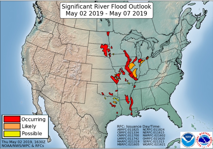
According to the May 2 NRCS Water and Climate Update, severe storms with heavy precipitation and tornadoes crossed the Midwest this week. Another week of flooding accompanied the storms in a wide swath along the Missouri, Mississippi, and surrounding rivers.

Some areas received up to 8 inches of precipitation this week. In Davenport, Iowa, a section of the flood control system was breached Wednesday with evacuations in place. Flash floods in Texas and Oklahoma followed heavy rain in the area where severe storms spawned 29 tornadoes.
The 3-month outlook from the National Weather Service indicates that above normal seasonal mean temperatures are most likely for the eastern and western thirds of the U.S., including Alaska, for May through July. Below normal seasonal mean temperatures are more likely for parts of the Central and Southern Plains.

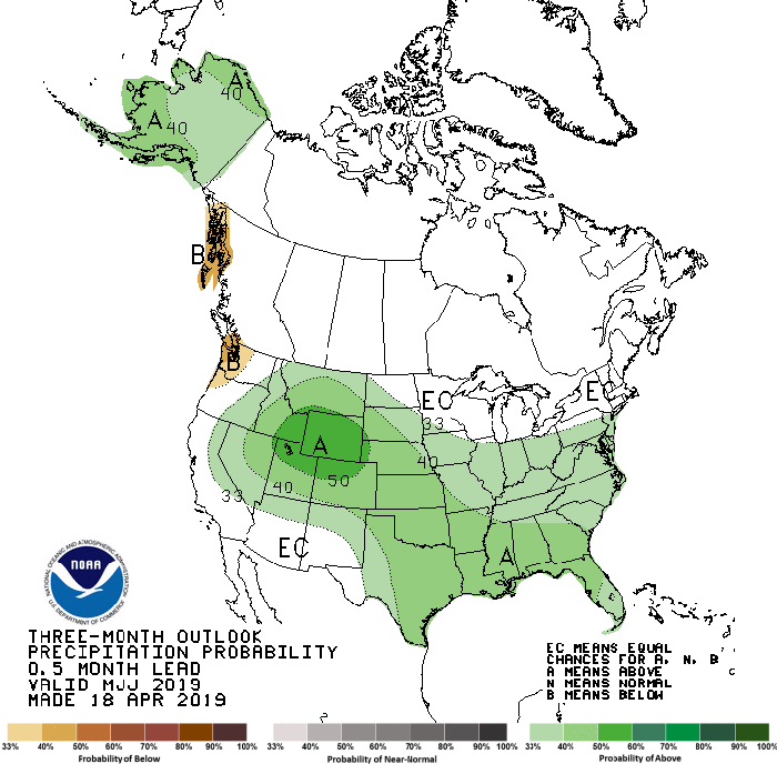
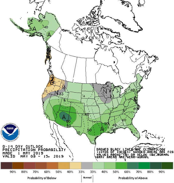
The May-July 2019 precipitation outlook indicates that above normal seasonal total precipitation is most likely for much of the U.S., including the interior West across much of the Great Plains into the Central Mississippi and Ohio Valleys, the Southeast region, and along the Atlantic Coast from Florida to the Mid-Atlantic. The greatest probabilities for above normal seasonal total precipitation are for areas of the Central Rockies. Below normal precipitation is more likely for a small area of the Pacific Northwest near the coast.

Looking ahead, the National Weather Service predicts the continuation of an El Nino through 2019. Little possibility of a La Nina event next winter is indicated by statistical and dynamical model forecasts.
While La Nina events often emerge in the year following an El Nino in the climate record, at other times El Nino events extend beyond one year, as predicted by a significant number of the forecast tools. The probability of a continuation of the current El Nino into next winter is set at about 50%.
Source: NRCS and NWS, which are solely responsible for the information provided and are wholly owned by the source. Informa Business Media and all its subsidiaries are not responsible for any of the content contained in this information asset.
You May Also Like
.png?width=300&auto=webp&quality=80&disable=upscale)


